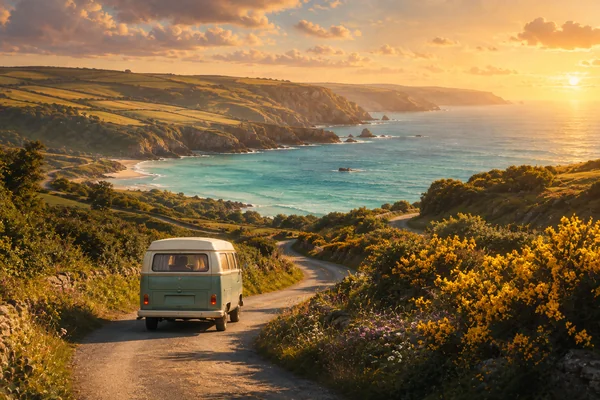
Quick answer: the classic Cornwall road trip is a loop — down one coast, back along the other, with the moor in between. Give it three days minimum, five if you can; drive the A30 across Bodmin Moor for the views and the lanes for the coves; base yourself in two or three places rather than moving every night; and never trust a sat-nav on a Cornish lane. Four route ideas — including our own south-east loop — plus the practicalities, below.
Cornwall is made for driving slowly. It’s eighty miles long, rarely more than twenty wide, and edged the whole way round by a coast that changes character every ten miles — surf beaches on the north, wooded creeks on the south, granite and myth at the far end, and a wild moor down the middle. This guide gives you four road-trip shapes to build from, the roads worth driving for their own sake, and the hard-won practicalities of Cornish lanes.
Table of Contents
- Before you set off
- Route 1: our south-east loop
- Route 2: the north coast, Padstow to Land’s End
- Route 3: the south coast and the Lizard
- Route 4: across Bodmin Moor
- Driving in Cornwall: the realities
- Personal insights and experiences
- FAQ
- References and resources
Before you set off
- Get here first — our guide to reaching Cornwall covers the A30-versus-A38 choice and when to travel.
- Two or three bases, not seven. Distances are short but speeds are slow; unpacking every night eats the holiday.
- Check the weather by coast — the north and south can have different days; our weather guide explains why, and it changes which way round to run a loop.
- Book the honeypots — Tintagel Castle, the Minack, the Eden Project and popular restaurants all need advance booking in season.
Route 1: our south-east loop
Our home patch, and the best introduction to Cornwall for anyone arriving over the Tamar. From Saltash, drop south to Looe — the working harbour, the fishing boats, a pasty on the wall — then the lanes to Polperro, car-free and improbably pretty. Cut inland and down to Fowey (or take the tiny Bodinnick ferry), then round to Par Sands, our family’s beach of a lifetime, and Charlestown‘s tall ships. Home via Liskeard and the A38 — or, if you’ve time, up onto the moor. One long day or two easy ones; every stop has swimming, food and a harbour to sit on.
Route 2: the north coast, Padstow to Land’s End
The Atlantic coast, top to bottom. Start at Boscastle and Tintagel (a pair — see our Tintagel guide), then Padstow, Watergate Bay and Newquay‘s surf beaches, Perranporth‘s three miles of sand (excellent rock pooling), the engine houses of St Agnes, Godrevy for the seals, St Ives (park at St Erth and take the train), then the granite far west to Sennen and Land’s End. Two to three days. The B3306 from St Ives to St Just is one of the finest coast roads in Britain.
Route 3: the south coast and the Lizard
Softer, greener, wooded creeks and sheltered water. From Mevagissey and the Roseland (St Mawes, the King Harry ferry across the Fal), on to Falmouth, the Helford‘s creek-side lanes and Frenchman’s Creek, then the Lizard — Kynance Cove, Britain’s most southerly point, and choughs on the cliffs — finishing at Marazion with St Michael’s Mount across the causeway. Two days; the swimming is calmer here than the north, and the pubs are on the water.
Route 4: across Bodmin Moor
Not a loop but a crossing, and my favourite drive in the county: the A30 over Bodmin Moor, big open skies, Colliford Lake shining beside the road, Jamaica Inn at Bolventor, and the tors on the horizon. Turn off for the Cheesewring and the Hurlers stone circles at Minions, for Golitha Falls (see our woodland walks), and for Bodmin Jail. Half a day, or the return leg of any northern trip — which is exactly how we use it.
Driving in Cornwall: the realities
- Lanes. Single-track with high hedges is normal. Passing places exist; use them, wave, and expect to reverse. Slow down before blind bends, not on them.
- Sat-nav will route you down farm tracks and through fords to save ninety seconds. Follow the road signs to towns instead, and use the sat-nav for the last mile.
- Parking at popular beaches and villages fills by mid-morning in summer; arrive early, use park-and-ride where it exists (St Ives especially), and carry change for the older machines.
- Fuel and charging — top up before the far west.
- Ferries save miles and make the day: King Harry, Bodinnick, Padstow–Rock (foot), St Mawes.
- Camper vans — welcome, but know your width before the Polperro lanes; overnight parking is restricted in most car parks.
Personal insights and experiences
I drive Cornwall’s roads all the time — the A38 out of habit and necessity, the A30 by choice — and if you asked me for the single best hour behind a wheel here, it’s the A30 across the moor coming home from a camping trip: the open stretches, the moor falling away, Colliford Lake catching the light. We take the quick way out and the good way back, always.
Route 1 is the one we actually drive most, though, and it’s the one I’d give a first-timer. Looe, Polperro, Fowey, Par, Charlestown: it’s small, it’s close, and it packs in a working harbour, a car-free fishing village, a river town, our favourite family beach and a tall-ship harbour before tea. It taught our children Cornwall. And it ends, on a good day, with the road home past Tideford, where the River Tiddy may have flooded the reed meadow into a lake — the best kind of Cornish full stop.
FAQ
Q: How many days do you need for a Cornwall road trip?
A: Three days covers one coast well; five to seven lets you loop both coasts and the moor without rushing. Distances are short but Cornish roads are slow.
Q: What is the most scenic drive in Cornwall?
A: The B3306 from St Ives to St Just along the far-west coast, and the A30 across Bodmin Moor, are the two great ones; the Helford and Roseland lanes are the loveliest slow drives.
Q: Is driving in Cornwall difficult?
A: The main roads are easy; the lanes take nerve and manners — single-track, high hedges, reversing to passing places. Go slowly and it’s part of the fun.
Q: Should I do the north coast or the south coast?
A: North for surf beaches, drama and Tintagel; south for sheltered creeks, calmer swimming and the Lizard. Do both if you have five days — the moor connects them.
References and resources
- Visit Cornwall — itineraries: www.visitcornwall.com
- National Trust Cornwall — coast and car parks: www.nationaltrust.org.uk
- Cornwall Council — ferries and park-and-ride: www.cornwall.gov.uk