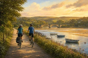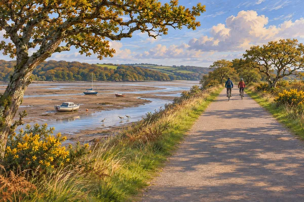
Quick answer: the Camel Trail is an 18-mile, free, traffic-free and virtually level route along a disused railway from Wenfordbridge through Bodmin and Wadebridge to Padstow. It is the easiest serious ride in Cornwall and the busiest. Cornwall Council’s own documents say it takes in excess of 500,000 visitors a year and that the Wadebridge to Padstow section is “at capacity” in peak season. That is the single most useful thing to know: everybody rides the same 5.5 miles. Ride the other two sections, or come out of season, and you get the same trail almost to yourself.
The Camel Trail is the one piece of Cornish cycling everybody has heard of, and most people do the same short stretch of it on the same week of the year. This covers the whole route, which section actually suits you, the hire and parking, and the honest problem with the famous bit. Our cycling guide covers the county’s other routes.
Table of Contents
- The route, section by section
- The honest problem, in the council’s own words
- Which section to ride
- Bike hire, parking and access
- What is actually along it
- Practical notes
- FAQ
- References and resources
The route, section by section
Three sections, and they are genuinely different rides. Distances are Cornwall Council’s.
| Section | Distance | What it is like |
|---|---|---|
| Padstow – Wadebridge | 5.5 miles (8.8km) | The famous one. Estuary views the whole way, and the busiest stretch by a long distance |
| Wadebridge – Bodmin (Boscarne) | 5.75 miles (9.25km) | Wooded river valley alongside the Camel. Quieter, greener, arguably prettier |
| Bodmin – Wenfordbridge | 6.25 miles (10.1km) | Climbs gently towards the fringe of Bodmin Moor. The quietest of the three |
It is a permissive path, open all year, and free. The surface is made up and virtually level because it is an old railway — the council describes it as traffic-free, smooth and suitable for families and for mobility-impaired users. There is a short on-road section through Wadebridge, which is the one place to pay attention.
The honest problem, in the council’s own words
Most guides sell you the Padstow end. Here is what Cornwall Council writes in its own guidance for event organisers:
“The Camel Trail is at capacity with its present user numbers during the peak season on the Wadebridge to Padstow section.”
The same document puts the trail’s usage at in excess of 500,000 visitors a year, and advises event organisers to avoid that section in peak season altogether.
So the advice writes itself. If you are coming in July or August, either start early, ride one of the other two sections, or accept that you will spend the ride overtaking and being overtaken. The Wadebridge to Bodmin stretch is the same gradient, the same surface and a prettier landscape, and on an August afternoon it is a different experience entirely.
Out of season the whole thing changes. The trail is open year-round and in February you can have the estuary to yourself. Our off-season guide covers what else is running, and the winter walks guide makes the same case on foot.
Which section to ride
If you have children, or two hours
Wadebridge to Padstow and back — 11 miles round, flat, with the estuary beside you and food at both ends. It is the obvious choice and it is the obvious choice for everyone else too, so go early.
If you want the nicest ride
Wadebridge to Boscarne and back. Wooded, riverside, and far quieter. Most visitors never see it, which is the whole argument for doing it.
If you want distance
Padstow to Wenfordbridge is the full 18 miles, or 36 there and back, which is a proper day on a flat surface. Most people ride one way and arrange a lift, or split it over two days.
If you are walking rather than riding
All of it works on foot, and the Bodmin to Wenfordbridge end is the best of it for walking — quieter, and climbing towards the moor. Our woodland walks guide covers the wooded alternatives nearby.
Bike hire, parking and access
Bike hire
Available at Padstow, Wadebridge, Bodmin and Wenfordbridge. One thing the council is firm about: only licensed providers may hire bikes for the trail, and it asks you to check that yours is licensed. The licence fee goes back into maintaining the trail, so using a licensed hirer is not just box-ticking.
Parking
The trail uses existing car parks rather than its own. Council-listed access points include:
- Padstow — multiple car parks in the town
- Wadebridge — multiple car parks in the town
- Dunmere, Bodmin — at the Borough Arms, PL31 2RD
- Scarletts Well, Bodmin, Grogley Halt, Shell Woods and Old Town Cove (signed from St Issey)
- Wenfordbridge — a small car park at that end of the trail
Padstow parking is the hard part, as it is for everything in that town. Starting from Wadebridge or one of the smaller access points is easier and cheaper. Our parking guide covers how Cornish parking works and what changed in 2026.
Getting there without a car
Bodmin Parkway is on the main line. From there you can take the Bodmin & Wenford steam railway, though the council warns its timetable varies through the week, or cycle via Lanhydrock on National Cycle Route 3. Our branch lines guide covers the network.
Access
The council states the trail is suitable for walkers, cyclists, horse riders and wheelchair users, and the leaflet describes it as easy to use for mobility-impaired visitors. There is an accessible bird hide beside the trail near Wadebridge.
What is actually along it
It is not just a surface to ride on.
- The Camel Estuary itself, part of which is an Area of Outstanding Natural Beauty, with the tide doing something different every time you come.
- Protected habitat. The trail runs through both a Site of Special Scientific Interest and a Special Area of Conservation, which is why it is managed the way it is.
- Wildlife the council lists along it: otter, bats, dormice, kingfisher, little egret, marsh orchid and marsh marigold. Our wildlife calendar covers what to look for month by month.
- Refreshments at Padstow, the Old Quarry between Padstow and Wadebridge, Wadebridge, Nanstallon, Bodmin and Wenfordbridge. Toilets at Wenfordbridge, Wadebridge and in Padstow town centre.
- Camel Valley vineyard is near the Bodmin end — see our drinks trail guide, and note it is closed at weekends.
- Bodmin Jail and the Padstow lobster hatchery sit at either end. Our Bodmin Jail guide covers the first.
It also links to other trails — the St Piran Trail, the Coast and Clay Trail and the North Cornwall Trail — so it can be the start of something longer rather than an out-and-back. The tin mining heritage guide covers the industrial landscape several of those cross.
Practical notes
- Go early or go off-season. Said three times in this guide because it is the only thing that really changes the day.
- Check your hirer is licensed. The council asks you to, and the fee maintains the trail.
- Book bikes ahead in summer. Half a million visitors a year, and the hire fleets at Padstow and Wadebridge do run out.
- It is an estuary, so it is exposed. A headwind one way is normal; ride out into it and come home with it behind you. Our weather guide covers the wind, which matters more than the rain.
- Dogs are a common sight but the council page says nothing about them either way, so keep yours under close control on a shared path with cyclists at speed. Our dog-friendly Cornwall guide covers the wider picture.
- Mind the on-road bit at Wadebridge, which is where the traffic-free run breaks.
- OS Explorer 106 and 109 cover the route if you want paper.
- Pair it with Padstow rather than treating the town as just a finish line — our Padstow Christmas Fayre guide covers its best weekend, and the ferries guide covers the crossing to Rock. Our where to stay guide covers basing yourself.
FAQ
Q: How long is the Camel Trail?
A: About 18 miles from Wenfordbridge through Bodmin and Wadebridge to Padstow. Cornwall Council’s three section distances are 5.5 miles Padstow to Wadebridge, 5.75 miles Wadebridge to Bodmin, and 6.25 miles Bodmin to Wenfordbridge, which adds to 17.5; the council does not explain the difference.
Q: Is the Camel Trail free?
A: Yes. It is a permissive path, free to use and open all year. You pay only for parking and bike hire.
Q: Is the Camel Trail flat?
A: Virtually. It follows a disused railway, so it is level and surfaced, and the council describes it as traffic-free, smooth and suitable for families and mobility-impaired users. The Bodmin to Wenfordbridge end climbs gently towards the moor.
Q: Which section of the Camel Trail is best?
A: Wadebridge to Padstow for estuary views, which is also by far the busiest. Wadebridge to Boscarne is wooded, riverside and much quieter, and many people think it the nicer ride. Bodmin to Wenfordbridge is the quietest of the three.
Q: How busy does the Camel Trail get?
A: Cornwall Council’s own guidance says the trail takes in excess of 500,000 visitors a year and that the Wadebridge to Padstow section is at capacity during peak season. It advises event organisers to avoid that section then. Ride early, ride another section, or come out of season.
Q: Where can you hire bikes for the Camel Trail?
A: At Padstow, Wadebridge, Bodmin and Wenfordbridge. Only licensed providers may hire bikes for the trail and the council asks you to check that yours is licensed; the licence fee goes towards maintaining the trail. Book ahead in summer, as fleets do run out.
Q: Can you get to the Camel Trail by train?
A: Bodmin Parkway is on the main line. From there you can take the Bodmin & Wenford steam railway, whose timetable varies through the week, or cycle to the trail via Lanhydrock on National Cycle Route 3.
Q: Is the Camel Trail wheelchair accessible?
A: Cornwall Council states the trail is suitable for wheelchair users, and its leaflet describes it as easy to use for the mobility impaired, the surface being a level former railway. There is an accessible bird hide beside the trail near Wadebridge.
References and resources
- Cornwall Council — the Camel Trail: www.cornwall.gov.uk
- Bodmin & Wenford Railway: www.bodminandwenfordrailway.co.uk
- Sustrans — National Cycle Network: www.sustrans.org.uk
- Traveline South West: www.travelinesw.com