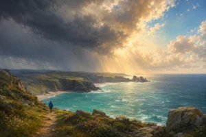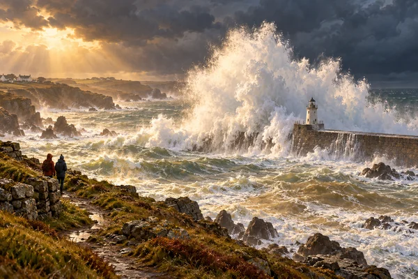
Quick answer: a Cornish storm is one of the best things you can see here, and watching it from the wrong place kills people. The rules are simple and they come from HM Coastguard and the RNLI: stay off harbour walls, piers and jetties, keep well back from cliff edges and the water’s edge, watch at low or falling water rather than high tide, and use height and distance instead of getting close. A long lens from a clifftop path, a café window or a car park with a sea view gets you the same spectacle. The sea between the sets looks calm, and that is the trap.
Cornwall gets the first and the worst of the Atlantic. That is the price of the position and also the reward: between November and March the county puts on a show nowhere else in England can match. This piece is about watching it without becoming part of the story. It sits alongside our weather guide and the monthly spokes for January and February.
Table of Contents
- The rules, from the people who pull bodies out of the water
- Two mornings in Cornwall, four days apart
- When the storms come
- Reading the forecast: period beats height
- Where to watch, and three places not to
- If someone goes in
- Photography without the risk
- The best seat is behind glass
- The day after: the best beachcombing of the year
- Boscastle, 16 August 2004: the danger that isn’t the sea
- FAQ
- References and resources
The rules, from the people who pull bodies out of the water
HM Coastguard publishes five tips for big waves and high wind. The first is the one that matters most:
Keep off groynes, piers, jetties and harbour walls. Big waves can knock you over in a flash.
HM Coastguard, waves and wind safety
The rest of their list: playing dares with waves is dangerous in the best of weather, and rocks and walls are slippery; stay well away from cliff edges, especially in wind; note the tide times so you don’t get trapped, and take a charged phone; keep dogs on leads. More dogs are saved than people, and most of the people who drown went in after a dog.
The RNLI’s line, repeated before every named storm, is the same: don’t go out in extreme wind to experience it, keep a safe distance from cliff edges, piers and waterfronts, and do not risk your life for a photograph. Their most useful warning is about what the sea does rather than what it looks like. Ahead of a big swell in January 2026 they described waves running two to three hundred metres up the beach or topping harbour walls, with lulls between sets lasting as long as fifteen minutes.
Fifteen minutes. That is the whole problem. You arrive, the sea looks big but manageable, you walk out onto the wall or down the beach because nothing has happened for a quarter of an hour, and then the set arrives.
Two mornings in Cornwall, four days apart
This is not hypothetical, and the examples are recent.
Godrevy and Gwithian, 29 October 2020. Swell from the remains of Hurricane Epsilon swept nine people into the sea in a single incident. All nine were recovered, five of them airlifted, with injuries from cuts and bruises to water inhalation. The RNLI’s lifesaving manager afterwards asked people simply to stand well back from the sea. Gwithian is a wide, flat, shelving beach: the surge runs hundreds of metres inland and there is nothing to stop it.
Mullion Cove, 2 November 2020. Four days later, HM Coastguard logged a report of two people swept into the sea from the harbour there. A father and daughter, on the first day of a family holiday, both drowned. Witnesses at the inquest described the sea as boiling and savage, with waves regularly crashing over the top of the wall. The detective who gave evidence called it naivety rather than ignorance, which is the fairest thing anyone has said about it. They were standing where thousands of people stand on a calm day.
When the storms come
The Met Office puts it plainly: winter is the windiest time of year in the UK, as the jet stream moves south and the Atlantic sends more depressions across, with the north and west taking the brunt. There is no published monthly league table for Cornwall, so treat November to March as the season and don’t expect a schedule.
Cornwall’s record gust is 118 mph (102.5 knots) at Gwennap Head on 15 December 1979, which stood as England’s low-level record for more than forty years. Some of the storms people still talk about:
| Storm | What happened in Cornwall |
|---|---|
| Goretti, 8 January 2026 | A red wind warning for the Isles of Scilly and much of Cornwall. The Met Office’s chief forecaster warned of gusts of 100 mph or more and violent gusts persisting for two to three hours. |
| Darragh, 7 December 2024 | Amber wind warning county-wide: 70–80 mph on exposed coasts and headlands, 60–70 inland. |
| Eunice, 18 February 2022 | Red warning for the south west. Around 90,000 homes lost power across the region and Cornwall Council declared a major incident. |
| Imogen, 8 February 2016 | 79 mph recorded at Culdrose, a 19-metre wave measured offshore from St Ives, and spray at Sennen reaching the 78-metre clifftop. |
| 14 February 2014 | Porthleven took the full force. Penzance promenade, the lower sea wall and the Newlyn Green coast path were damaged and around twenty properties flooded, with further damage at Portreath, Porthmeor and Bude. |
Note the Imogen detail. Spray reached a clifftop seventy-eight metres up. Height is not the same as safety.
Reading the forecast: period beats height
Two numbers decide whether a storm is worth travelling for, and most people only look at one.
- Wave height is usually quoted as significant wave height, the average of the largest third. The biggest wave in a few hours runs roughly double the quoted figure. A 4-metre forecast can produce an 8-metre wave.
- Period is the gap in seconds between crests, and it is the better guide. Five to eight seconds is weak local wind slop. Nine to twelve is organising. Thirteen seconds and up is groundswell: generated far out in the Atlantic, carrying real energy, arriving in long sets with long quiet gaps in between.
- Tide multiplies everything. The spectacular overtopping happens when long-period groundswell meets an onshore southwesterly at high water on a spring tide, around a new or full moon.
Which is also the exact combination you should not be standing anywhere near. Watch the big stuff at low or falling water from high ground, and save the high-tide spring-tide show for a window.
Where to watch, and three places not to
Only places with something specific to say about them. A clifftop coast path section away from the edge, or a car park and café with a sea view, beats any of them for safety.
- Porthleven is the famous shot: the 70-foot Bickford-Smith Institute clock tower of 1884 on the granite harbour, with waves breaking over the defences behind it. The harbour faces southwest straight into the prevailing wind, which is why it works. The 2011 storms tore the harbour gates away and Storm Pierrick damaged the wall again in 2024. Shoot from back in the town, not from the pier.
- Carnewas at Bedruthan is the best option with facilities: National Trust clifftop above the bay, a tea room near the car park, and you watch from genuine height. The 140 steps to the beach are not a storm-day activity.
- Cape Cornwall is fully exposed Atlantic and takes some of the biggest waves in the county.
- St Agnes had waves hitting buildings during Storm Dennis in February 2020, which tells you how far the water reaches.
- Boscastle has a dramatic harbour entrance, a National Trust shop and a visitor centre in the Old Smithy to retreat into. See the Boscastle section below for why the river matters as much as the sea.
Three to stay off entirely:
- Mullion Cove harbour wall, where two people died in 2020.
- Portreath pier. The Monkey House lookout stood at the pier end for over a century and the 2014 storms obliterated it; it was rebuilt that summer. If a stone building can be removed from that pier, so can you.
- Penzance promenade and Newlyn at high water. Both were damaged in February 2014, Wherry Town was largely destroyed in the Ash Wednesday storm of March 1962, and the promenade is being reinforced against wave action again — work on the second phase started in January 2026.
Godrevy and Gwithian are not on either list on purpose. They are superb from the clifftop by the lighthouse view and lethal on the sand.
If someone goes in
Call 999 or 112 and ask for the Coastguard. Do not go in after them: the overwhelming majority of people who drown in these incidents entered the water to help someone else.
Shout at them to float: head tilted back, ears submerged, arms and legs out, letting the cold-water shock pass before trying to swim. Throw anything that floats — a throwline or life ring if there is one on the harbour wall, which is what they are for. Then keep eyes on them and keep talking to the Coastguard.
The reason floating works is the same reason the water is dangerous in the first place: it is cold enough to take your breath away in the first minute. Our cold-water guide covers that in more detail.
Photography without the risk
The RNLI’s bluntest line is about photographs, so start there: do not risk your life for one. Everything below is about getting the picture from somewhere survivable.
- 70–200mm, better still 300mm. A long lens buys you distance and does the compression that makes waves look as big as they felt. It is the single thing that separates a good storm photograph from a dangerous one.
- High ground, back from the edge. A long lens from a clifftop gets the harbour-arm shot without the harbour arm.
- A sturdy tripod. Framing handheld in a 60 mph gust is close to impossible.
- A deep lens hood keeps spray off the front element, which is otherwise a losing battle.
- Wipe everything down afterwards. Salt spray destroys electronics quietly, over weeks.
- Check the tide and keep an exit route before you think about the picture.
The best seat is behind glass
This is the recommendation that actually squares with every warning above, and it is not a consolation prize. A window over a bay in a full gale, with a drink in your hand, is the best storm watching in Cornwall.
The Headland Hotel at Newquay sells storm-watching breaks on exactly this premise, with spa access and dinner credit built in; dates and contents change, so check before booking. The cheaper version is any coastal café, pub or sea-view car park at the right moment. Our cosy pubs piece and the hot-tub cottages list both work as storm-watching accommodation by accident, and what is actually open off-season tells you which doors will be unlocked.
The day after: the best beachcombing of the year
A big storm empties the Atlantic onto the strandline, and the morning after is the richest beachcombing of the year. The swell is usually still running, so go on a falling tide, in daylight, the calmer day after rather than during.
- Mermaid’s purses, the empty eggcases of sharks, skates and rays, which the Shark Trust describes as tough leathery cases protecting the embryo as it develops. Shape and features identify the species, they wash up among the seaweed in the strandline, and the Trust’s Great Eggcase Hunt has collected more than half a million records since 2003.
- By-the-wind sailors (Velella velella): small oval blue discs with concentric rings and a stiff fin-like sail, washed up in their thousands after a sustained onshore blow. Not a true jellyfish but a colony, more closely related to the Portuguese man o’ war.
- Goose barnacles on storm-driven driftwood, sometimes with Columbus crabs living in the cavities, having crossed the Atlantic attached to it.
If you find a stranded animal, dead or alive, report it to Cornwall Wildlife Trust’s Marine Strandings Network on 0345 201 2626. They are the licensed recorder for the whole county and the calls rise through winter. Our wildlife calendar and seals guide cover what else the season brings, and Surfers Against Sewage’s Million Mile Clean is the obvious thing to do with what the storm leaves that isn’t natural.
Boscastle, 16 August 2004: the danger that isn’t the sea
Cornwall’s most famous storm disaster had nothing to do with waves. On a summer afternoon, more than 200mm of rain fell in about five hours on the high ground behind Boscastle, and the Valency and Jordan rivers funnelled it through the village at walking-to-running speed.
Seventy-nine cars and five caravans were washed out to sea, six buildings were demolished, four bridges destroyed and around sixty properties flooded. Roughly 150 people were airlifted out by seven helicopters, the operation running past half past two in the morning. Nobody died and the worst injury was a broken thumb, which remains astonishing. Flood defences were completed in 2008.
Twenty years on, the Met Office’s own assessment was that higher-resolution models would now pick out an event that small with more warning. The lesson for a storm trip is that the wind and swell forecast is only half of it: watch the rainfall warnings too, and know your inland route out of a steep-sided valley.
FAQ
Q: Is storm watching in Cornwall dangerous?
A: It is as dangerous as you choose to make it. Watching from high ground well back from the edge, or from behind glass, is safe. Standing on a harbour wall, pier or open beach is how people are killed: nine people were swept into the sea at Gwithian in October 2020 and two died at Mullion Cove four days later.
Q: When is the best time for storm watching in Cornwall?
A: November to March. The Met Office notes that winter is the windiest time of year in the UK, with the jet stream further south and more Atlantic depressions crossing. There is no published monthly breakdown for Cornwall, so watch the forecast rather than the calendar.
Q: Where is the best place to watch storms in Cornwall?
A: Porthleven is the classic view, photographed from back in the town rather than the pier. Carnewas at Bedruthan gives clifftop height with a car park and tea room, and Cape Cornwall is fully exposed to the Atlantic. Avoid the harbour wall at Mullion Cove, Portreath pier, and Penzance promenade at high water.
Q: What do the numbers in a swell forecast mean?
A: Quoted wave height is usually significant wave height, the average of the largest third, and the biggest wave in a few hours runs roughly double it. Period matters more: 13 seconds or more means Atlantic groundswell with real power and long lulls between sets. Add an onshore southwesterly and a spring high tide and harbour walls overtop.
Q: What should I do if someone is swept into the sea?
A: Call 999 or 112 and ask for the Coastguard. Do not enter the water. Tell them to float on their back with their head tilted and ears submerged until the cold-water shock passes, and throw them anything that floats.
Q: Is there anything to do after a storm?
A: The strandline after a big blow is the best beachcombing of the year: mermaid’s purses, by-the-wind sailors and goose barnacles on driftwood. Go on a falling tide in daylight on a calmer day after, and report any stranded animal to Cornwall Wildlife Trust on 0345 201 2626.
References and resources
- HM Coastguard — waves and wind safety: top 5 tips: www.gov.uk
- HM Coastguard — what to do at the coast: hmcoastguard.uk
- HM Coastguard — rescue launched after two swept into water at Mullion Cove: hmcoastguard.uk
- RNLI — renewed warnings after a major incident in Cornwall, October 2020: rnli.org
- Met Office — the windiest place in the UK: weather.metoffice.gov.uk
- Met Office — red warning for wind as Storm Goretti approaches: www.metoffice.gov.uk
- Met Office — twenty years on from Boscastle: www.metoffice.gov.uk
- Cornwall Council — take care as Storm Eunice hits Cornwall: www.cornwall.gov.uk
- Shark Trust — the Great Eggcase Hunt: www.sharktrust.org
- Cornwall Wildlife Trust — Marine Strandings Network: www.cornwallwildlifetrust.org.uk
- Surfers Against Sewage: www.sas.org.uk